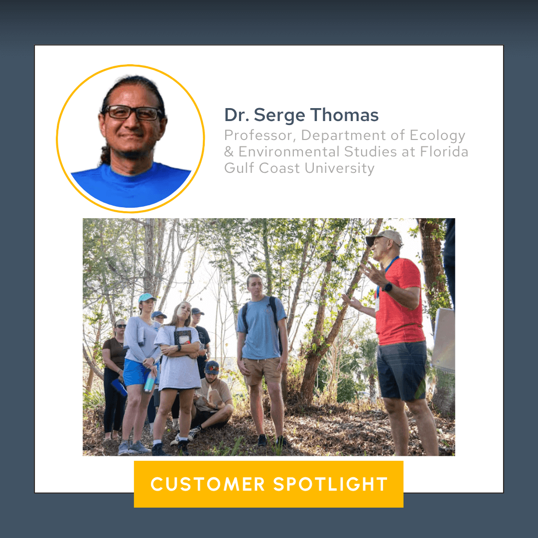
Equipping the Next Generation at Florida Gulf Coast University: Diving into Dr. Serge Thomas’ Limnology Class
Equipping the next generation of scientists goes beyond textbooks and lectures—it requires giving students hands-on experience with the tools and techniques they’ll use in the field. When students graduate and step into real-world roles, theory alone won’t help them; they’ll require confidence in the software, equipment, and methods that drive modern environmental science.
One person giving students what they’ll need to succeed is Dr. Serge Thomas, Ph.D., a professor and researcher in the Department of Ecology & Environmental Studies at Florida Gulf Coast University (FGCU). In his limnology class, Dr. Thomas is blending fieldwork with professional software training to prepare students for life beyond the classroom.
A Closer Look at Dr. Thomas, FGCU, and the Limnology Class
Located in Southwest Florida, FGCU is one of the state’s 12 public universities—and a relatively young one at that. Just over two decades old, FGCU has quickly developed a strong reputation for its focus on teaching and applied research, especially within its innovative Water School, which houses a wide range of environmental science and sustainability programs.
One of the faculty members leading the charge is Dr. Thomas, who has a passion for both science and education. Dr. Thomas teaches limnology, the study of inland waters—derived from the Greek word limne, meaning “lakes, ponds, or marshes,” and ology, meaning the “study of” a particular subject.
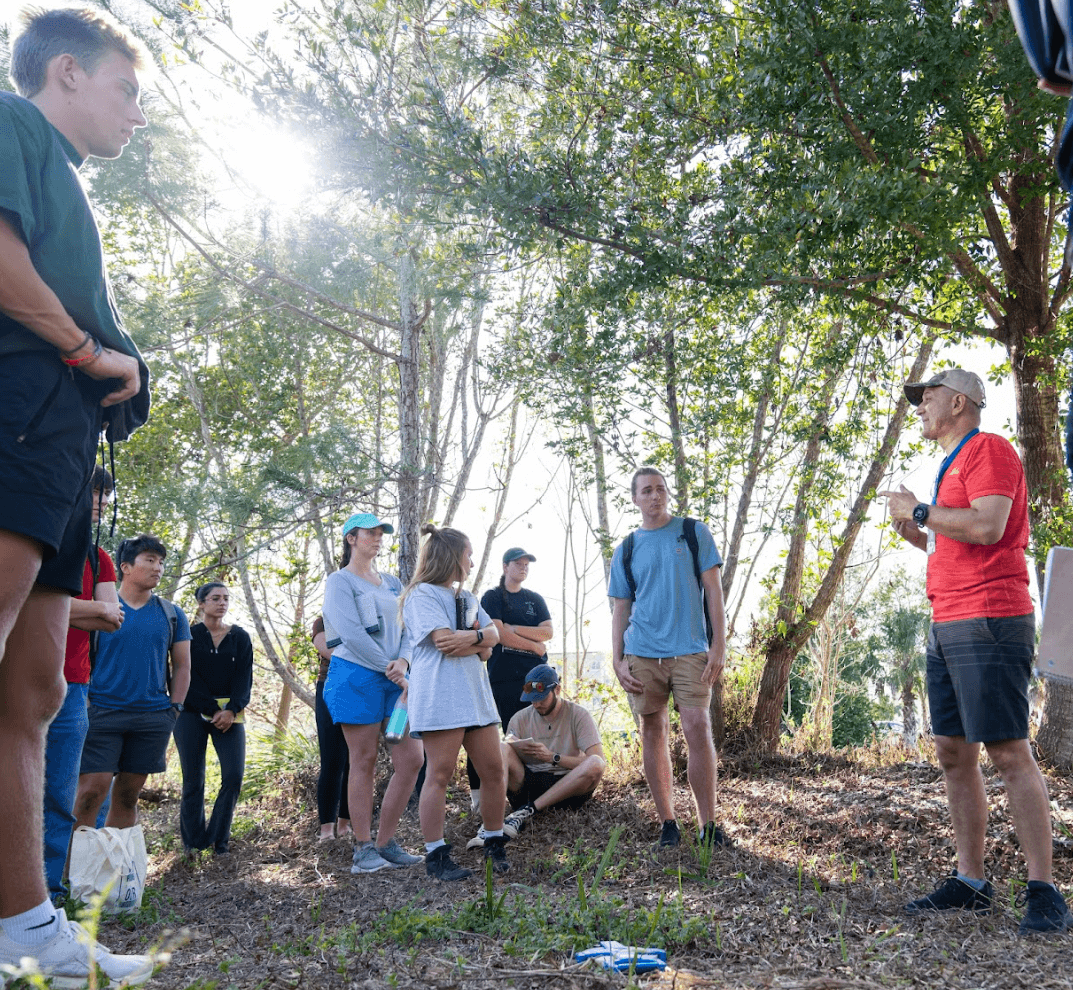
In his limnology class—offered to both undergraduates and graduates—Dr. Thomas blends research and teaching in a way that gives students a taste of the real work scientists do in the field. With about 35 students enrolled each year, the course goes far beyond lectures by teaching students how to do limnology.
“Part of my main work here as a researcher is involving the students in what I do for my research,” Dr. Thomas explained. “I expose them to mock projects, but they’re actually doing real-world tasks.”
This exposure gives students experience with field methods, data collection, and professional-grade analysis and visualization tools like Surfer, all of which can help them excel in careers after graduation.
From Tape Measures to Drones: How the Class Has Evolved with Technology
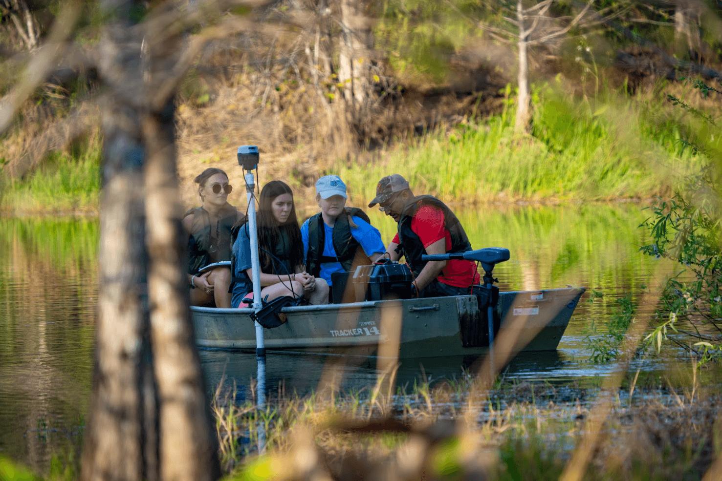
When Dr. Thomas first started teaching limnology at FGCU back in 2008, his students’ surveys on the campus lakes were entirely manual. Armed with nothing more than canoes, tape measures with weights and handheld GPS, students would make transects across the lakes—measuring water depth by hand at fixed intervals from one shore to the other. Using basic trigonometry, they’d map out the lake bottom and create a rough bathymetric profile. This hands-on approach laid a solid foundation, but as technology advanced, so did the class. The first major upgrade? Sonar.
“At the beginning, I used just a fish finder,” Dr. Thomas said when explaining how he started incorporating sonar into his class. “It not only gave me the positioning on the lake—such as the X and Y coordinates—but also the water depth in Z coordinates. With this, we actually had more points, which was more valuable.”
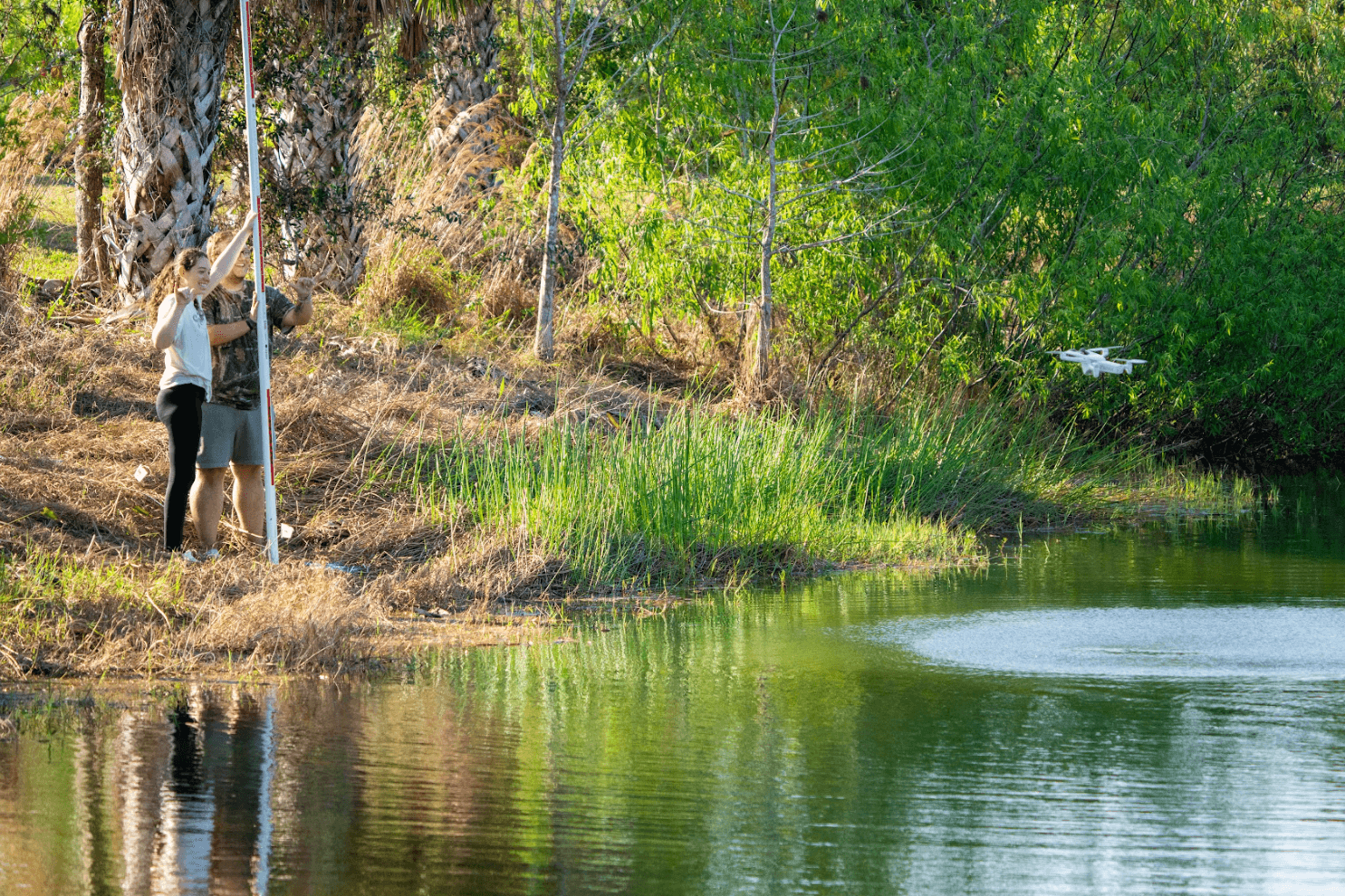
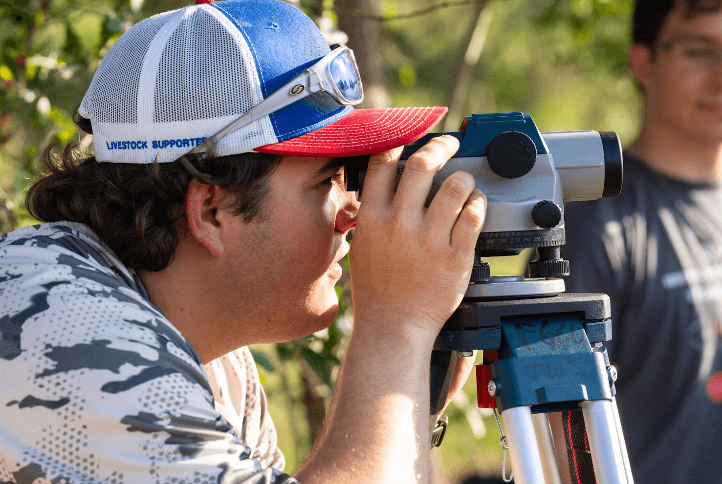
The only problem? Winter classes presented a challenge: Florida’s dry season often caused lake levels to drop, leaving gaps in shoreline data since measurements were based solely on water depth. To fill those gaps, Dr. Thomas began incorporating surveying tools like stadia rods to gather elevation points along the shore. Still, the coverage was limited—until drones entered the picture.
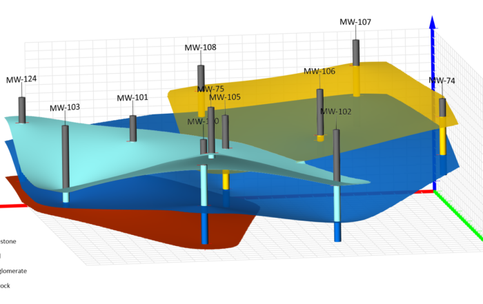
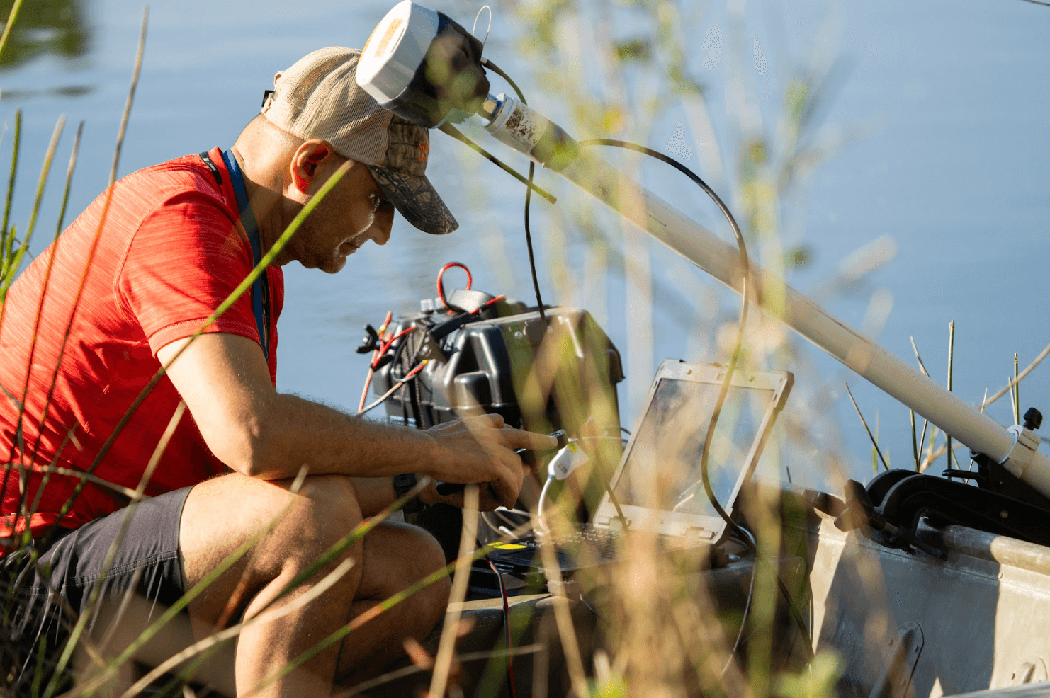
In 2015, drone technology transformed both Dr. Thomas’ research and his classroom. Using a DJI Phantom 4 Pro and photogrammetry software like Pix4D, his students began creating digital surface models (DSMs) of a lake and converting them into digital terrain models (DTMs) by removing vegetation and surface features. This aerial data was then combined with bathymetric measurements and GNSS-based elevation data (referenced to the NAVD88 vertical datum) to create a detailed visualization of the lake and surrounding terrain.
And this is where Surfer comes in. A longtime user of Surfer dating back to his grad school days, Dr. Thomas has his students use the software to interpolate their data, create accurate visualizations, and calculate key metrics like lake volume, surface area, and mean depth. The students also dive into variograms, interpolation techniques, and model their results—learning not only the science, but the full technical workflow they’ll encounter in the field.


Turning Lab Work into Real-World Impact
What makes Dr. Thomas’ limnology class truly stand out is that the work students do isn’t just academic—it’s deeply tied to real-world environmental challenges. Every field exercise and visualization they create plays a role in solving practical problems related to water quality, lake management, and environmental compliance.
For example, once students build a complete bathymetric map of one of the campus lakes, they don’t stop there. That map becomes the foundation for real scientific decision-making, like analyzing slope stability for regulatory compliance. Florida state guidelines require a 4:1 slope for shoreline safety and erosion control, and Dr. Thomas and his students use the elevation data to evaluate whether the lakes on campus meet those standards.
The data also feeds into one of Dr. Thomas’ main research areas: eutrophication—the excessive accumulation of nutrients that leads to the overgrowth of algae. Students use their morphometric models, built in Excel using volume and surface area calculations generated in Surfer, to determine the percentage of the lake that can support algae growth. From there, they assess how to mitigate the issue—whether by applying dye to limit light penetration or calculating the exact concentration of algaecide needed to treat the problem effectively and responsibly.
And it doesn’t stop with the water. Students also explore the interaction between light, depth, and algae growth, applying real measurements of light attenuation in the water column to determine how deep algae can thrive. This insight helps drive lake management strategies and gives students a tangible example of how the science they’re learning translates directly to environmental action.
Teaching with Purpose, Tools, and Impact
Dr. Serge Thomas’ limnology class is more than just a university course—it’s a model for how science education should be done. By combining fieldwork, cutting-edge technology, and professional-grade tools like Surfer, he’s giving students not only a deep understanding of environmental science, but also the confidence and capability to apply that knowledge in the real world.
Want more stories like this? Subscribe to our blog and stay up to date on how scientists, educators, and professionals across the globe are using Surfer and Grapher to explore, visualize, and make sense of the world.
Subscribe to the Blog