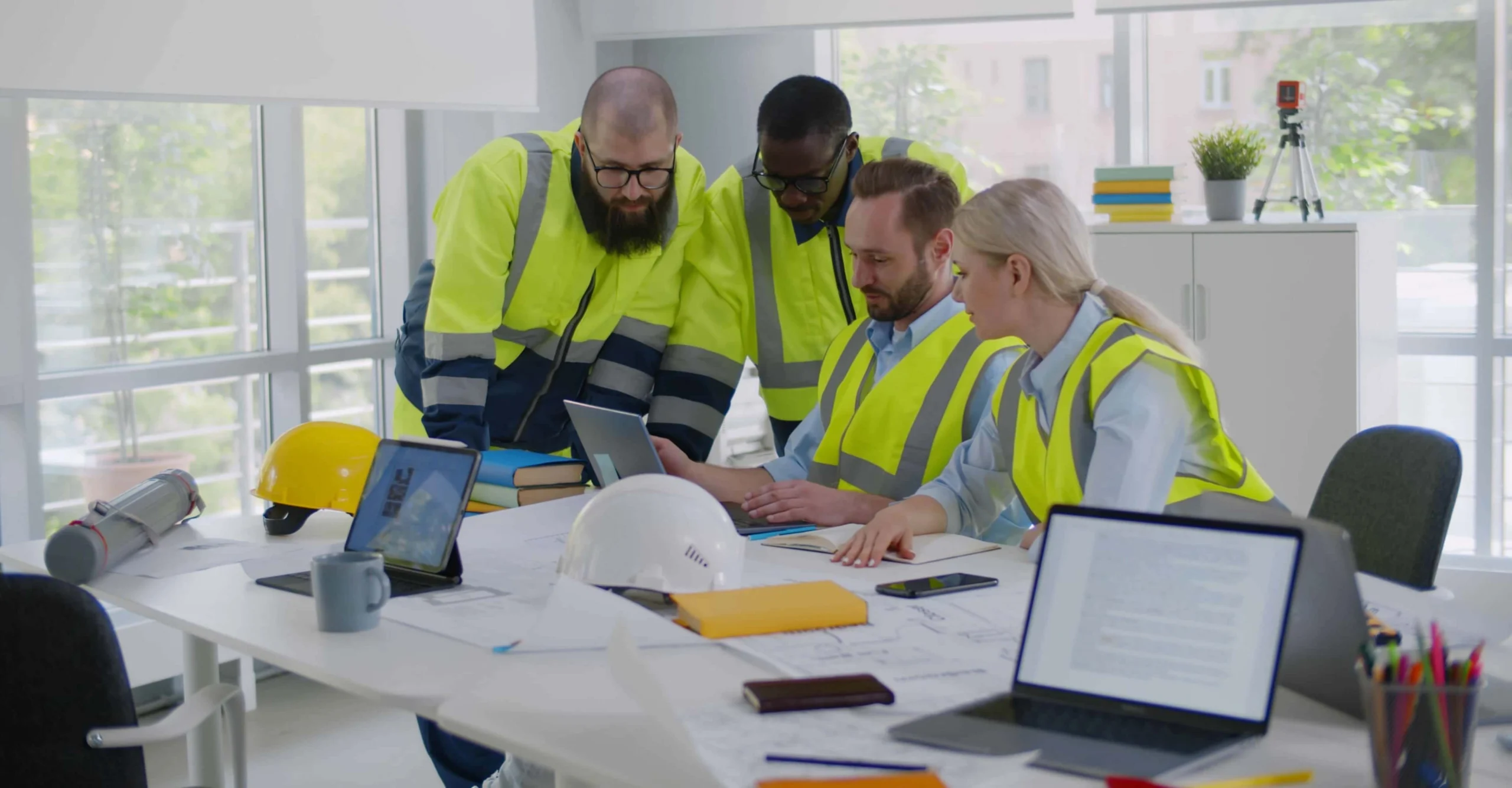
3D Models Sound Cool—But Are They Really Worth Creating?
3D modeling has become a buzzword across the geoscience and engineering community, and for good reason. From effectively visualizing subsurface features to clearly communicating project results to stakeholders, 3D models offer a level of precision and understanding that flat visuals simply can’t match. However, it’s still fair to wonder: is creating a 3D model truly worth it? In our opinion, it’s absolutely worth it.
Why Many Hesitate to Create 3D Models
Before highlighting why you should create 3D models, let’s explain why it’s hard to even entertain the thought. For many geoscientists and engineers, the idea of creating a 3D visual sounds great in theory—but in practice, it often feels unnecessary or even intimidating. There are two specific reasons for this, such as the ones below.
You don’t see any clear benefits
When 3D modeling isn’t explicitly required by stakeholders, it’s easy to question its value. If your 2D map will communicate insights, creating a 3D model can feel like extra effort without a clear reward. From that perspective, 2D works just fine. Why invest extra time building something that doesn’t appear to move the project forward right now? That’s especially true when you’re juggling multiple deadlines. When time is limited, it’s natural to prioritize what’s proven, familiar, and fast.
You don’t want to learn another tool
Even though certain 3D modeling tools are more intuitive than ever, learning something new can still feel like another task on a long to-do list. Consequently, you may explore 3D tools but stop short of truly giving it a chance simply because you don’t want to add something to your task list when you already have many client projects to complete.
The Benefits That Make a Difference
While the reasons for avoiding 3D are understandable, the value of this visualization is enough to seriously consider designing one. To give you more context, here’s how 3D models change the game for geoscientists and engineers.
Deeper insight into the surface and subsurface
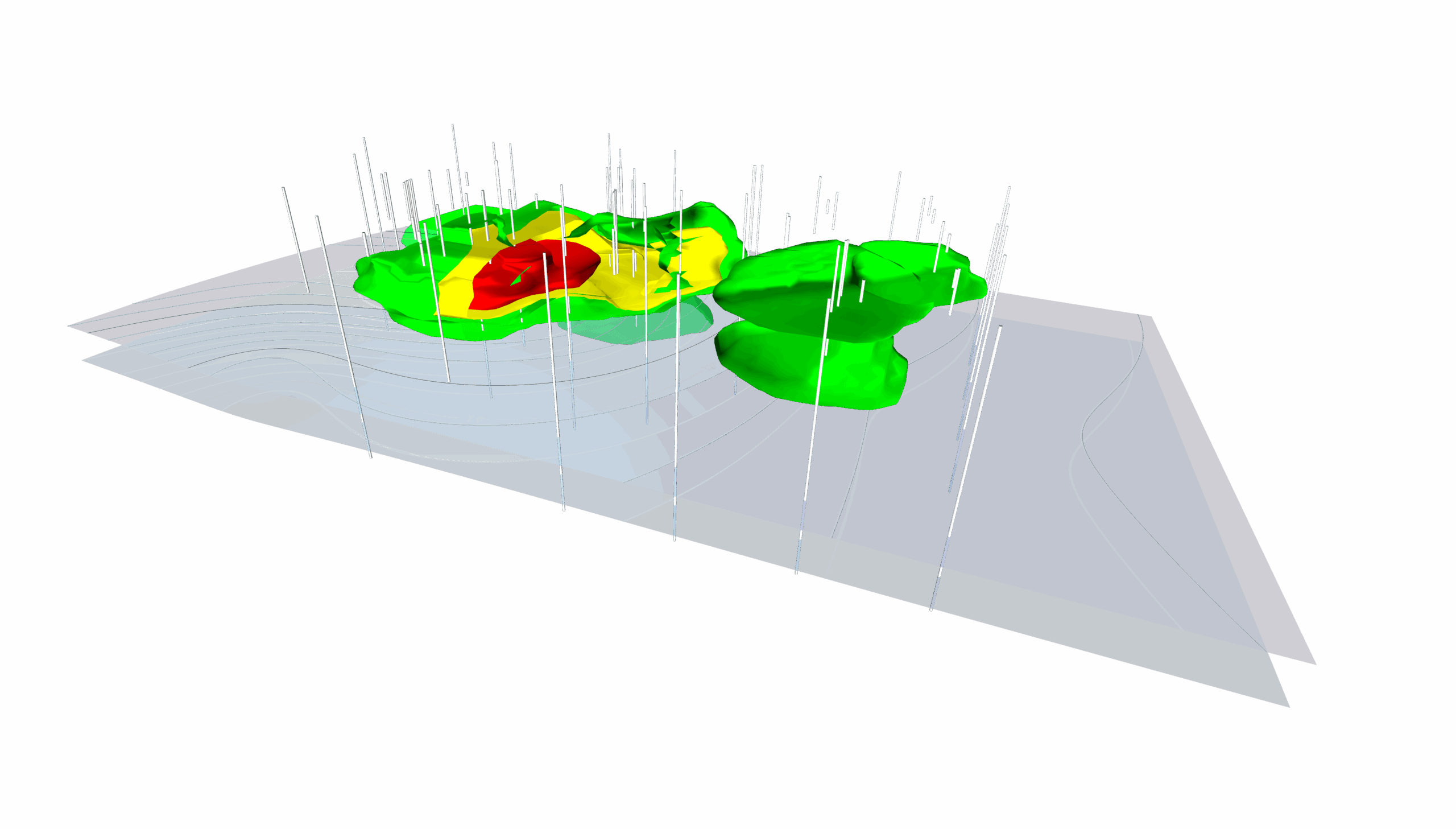
Visualizing both surface and subsurface data is inherently complex. In 2D, it often requires extensive explanation, as stakeholders try to piece together insights from multiple maps or interpret crowded information on a single visual. A 3D model removes that friction by providing a clear, spatially accurate picture of what’s happening above and below the surface. For example, you can show how a contamination plume extends beneath buildings or infrastructure, or how subsurface features align with proposed drilling targets, making spatial relationships immediately clear without extra explanation.

A clearer understanding that drives better conversations
3D models bring your data to life. Instead of asking stakeholders to interpret flat layers and contour lines, you’re giving them a realistic, spatially accurate view of the environment you’re studying. This makes it easier for both technical and non-technical audiences to intuitively understand what’s happening and why it matters.
Because the data is easier to grasp, conversations improve, too. Stakeholders can explore the model, ask better questions, and engage in more meaningful discussions. Rather than asking for explanations about your 2D map, everyone is looking at the same clear, cohesive visual, which leads to productive conversations that drive decisions.

Integration that connects every data source
Most water resource, environmental, and geotechnical projects rely on data from multiple sources. A 3D model can bring all those pieces together into one coherent view. That way, you can pull insights from your data more easily than if you were analyzing everything on a 2D map. This integrated perspective makes it easier to spot gaps, inconsistencies, and meaningful connections across datasets.
Quantifiable results that drive real-world impact
Beyond visualization, 3D models allow for true volumetric analysis. You can measure things like ore reserves, aquifer storage capacity, or contaminant volume, helping you estimate resources, assess project feasibility, or calculate remediation needs with precision. It’s not just about seeing your data but also quantifying it accurately to support better planning and cost decisions.

The Benefits of 3D Models in Action
The advantages of creating 3D models are clear and also easy to see in every corner of geoscience and engineering. Whether you’re uncovering history, managing groundwater, or planning infrastructure, 3D visualizations can bring value to your work. Here are just some of the most impactful ways 3D models can shape projects in various industries.
Archaeology: Unveiling the past for smarter excavation
By combining ground-penetrating radar (GPR) or magnetometry data with a digital elevation model (DEM), archaeologists can generate a 3D visualization of subsurface features like foundation walls, ditches, and hearths. This equips teams to see the layout and depth of archaeological sites before breaking ground so they can target excavations precisely, reduce cost and time, and preserve fragile artifacts that might otherwise be lost.
Environmental science: communicating risk and guiding remediation
Environmental scientists can transform borehole and chemical sampling data into a 3D plume model showing contaminant concentrations through subsurface layers. By overlaying this with satellite imagery, they can design a clear picture of where contamination is concentrated and how it’s spreading. This can help regulators, engineers, and community stakeholders instantly grasp the scope of contamination, leading to faster approvals, clearer communication, and more strategic placement of monitoring or recovery wells for effective remediation.
Engineering: improving site safety and design communication
Geotechnical engineers can integrate borehole logs, seismic refraction data, and cross-sections into a 3D model of the subsurface. By creating this model, they can highlight layers of soil and rock, groundwater zones, and structural weaknesses that could affect foundations or tunnels. This model could help both engineers and clients quickly visualize potential hazards or stability concerns, leading to more informed site selection and design adjustments before construction begins.
Water resources: understanding aquifer geometry and vulnerability
Hydrogeologists can use well log and geophysical data to build 3D representations of aquifers, showing where groundwater is stored and how it moves through the system. With this visualization, water resource managers can easily identify recharge zones, discharge areas, and areas at risk of contamination. This can support better management decisions, such as setting pumping limits or designing effective protection zones, and help communicate aquifer vulnerability to policymakers and the public.
Resource exploration: interpreting geology for smarter development
Exploration geologists can construct 3D models of ore deposits or reservoirs by interpolating core samples and geophysical survey data. They can then overlay drilling data to assess which zones have the highest economic potential. With the ability to view the resource from any angle, geologists can refine their interpretations, reduce unnecessary drilling, and optimize extraction strategies, saving time, minimizing costs, and maximizing resource yield.
Seeing Is Believing: 3D Modeling Is Absolutely Worth It
3D modeling is an easier way to communicate and understand data. By revealing depth, relationships, and spatial context that 2D maps can’t capture, 3D models help you give stakeholders clearer insights and stronger confidence in their decisions. They also help you connect complex datasets, uncover hidden patterns, and present findings in ways that everyone can understand.
So if you’ve ever questioned whether creating a 3D model is truly worth it, the answer is simple: it is. The impact it brings to your work makes it one of the most valuable tools you can use. Want to explore Surfer’s 3D tools to bring your data to life? Download the 14-day free trial of Surfer!
Recent Articles
- Jun 10, 2026|Gabbie Rhodes|9 min
During peak season, it’s hard to complete high-quality work on time. Fortunately, some practical workplace productivity hacks can help.
- Jun 10, 2026|Gabbie Rhodes|5 min
When it comes to software, the right licensing model matters. A one-time fee and subscription are common options. Which is right for you?
- Jun 3, 2026|Gabbie Rhodes|9 min
What's the difference between these two 3D data visualizations: 3D View and 3D surface maps? Discover their top differentiators.
- Jun 3, 2026|Gabbie Rhodes|8 min
Hiring a skilled geoscientist or engineer is the first step to strengthening your team. The next is training new employees for success.