Mapping Just Got Faster: Discover the Time-Saving Features in Our Latest Surfer Release
When you’re balancing a demanding workload and complex projects, there’s one thing you need: more time. Our latest version of Surfer is designed to provide exactly that, giving you more room in your day for problem-solving and educating stakeholders.
“Our primary goal with the latest Surfer was to save users time in making high-quality visualizations,” said Surfer Product Manager, Kari Dickenson. “Some of the latest features include frame templates and direct access to new high-quality, global image servers for downloading aerial imagery, empowering Surfer users to create their final 3D visualizations faster and with fewer clicks.”
You can start using the new features in Surfer today if you have an active subscription or active maintenance on a license. After updating Surfer, just open the program and you’ll have immediate access to several major updates that will accelerate your design process.
Quick, Easy Access to Downloadable XYZ Tiles Imagery
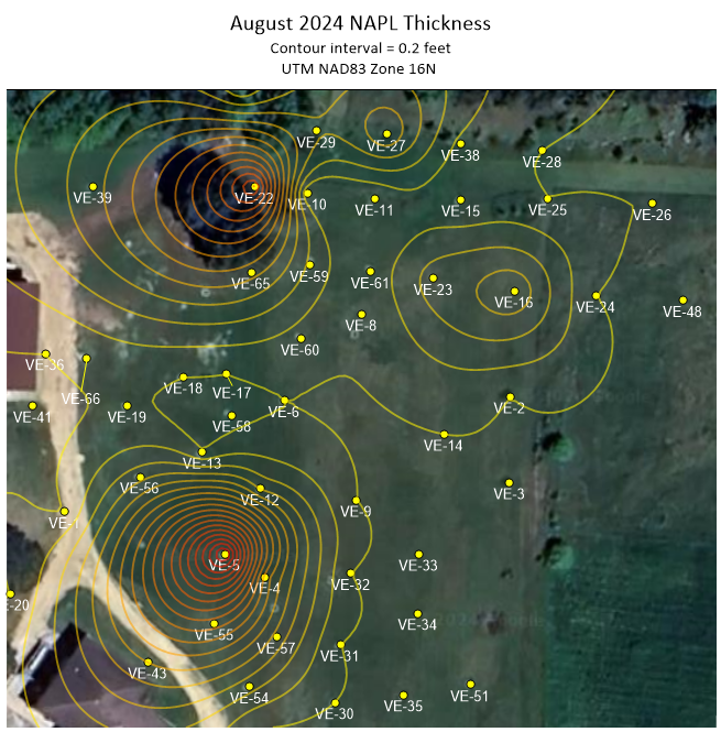
Telling a data-driven story to stakeholders is easier with georeferenced aerial and satellite images that provide real-world context for your maps. However, finding servers with images in the location and resolution you need can be time-consuming, challenging, and frustrating—turning your focus from solving complex scientific problems to grappling with graphic design issues.
Surfer now simplifies the process of obtaining the contextual imagery you need. With just a click, you can connect to various reliable XYZ Tiles servers to download high-quality maps, aerial photos, and satellite imagery with global coverage.
OpenStreetMaps is just one of the many reliable, global databases now accessible by Surfer. With this direct connection to downloadable XYZ Tiles imagery, you can obtain superior images quickly to use as base maps for your Surfer projects to better engage and captivate stakeholders.
Customizable Frame Templates for Repeated Use
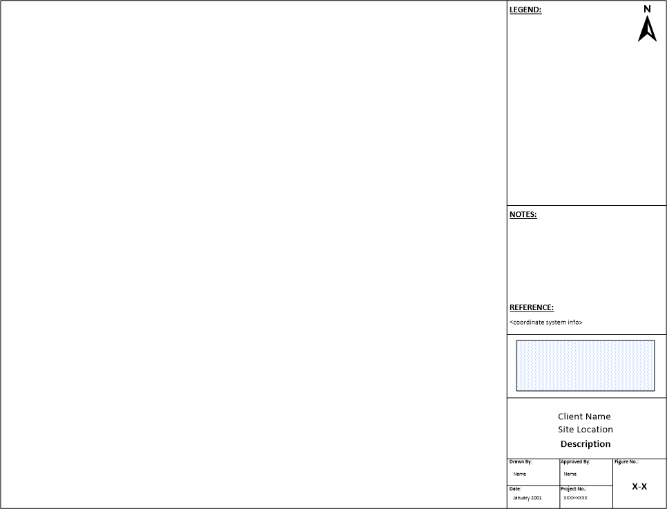
Remember when you wanted to build a company template for a series of maps but didn’t want to start from scratch? Surfer now ensures you never have to do so. Instead of tackling the daunting, tedious task of manually creating a template, Surfer now has over 20 ready-to-use frame templates to help you get started. All you have to do is open the template that catches your eye, customize it with company data, and save it for all future projects.
You can tailor a template to have specific elements like a title block, page size, legend, frame style, logo, and more. Once you save and open the template for another project, you can build on what you’ve already designed, speeding up your visualization process. Of course, access to our suite of frame templates doesn’t mean you can’t create a template from scratch. You’ll still have the option to build one from the ground up whenever you prefer.
More Robust, User-Friendly 3D View Tools
We’ve enhanced several aspects of the 3D view, equipping you to create high-quality visualizations with fewer clicks and less effort. The new tools available in Surfer include:
- Copy and Paste Format: Previously, creating similar 3D visualizations required manually entering the same properties for each map, leaving room for errors. Now, you can copy the properties from an existing 3D visualization and paste them into another, reducing mistakes and speeding up your work.
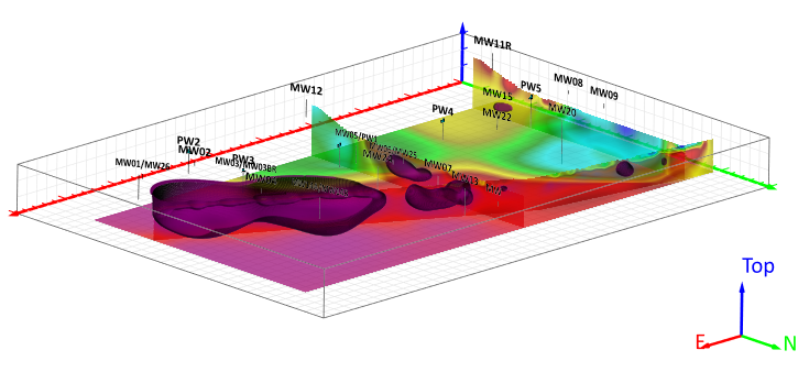
- 3D Triad: You can easily see how your 3D model is oriented with Surfer’s new customizable Triad, which you can add to any corner of your 3D view.
- Perspective or Orthographic Projection: Use perspective projection to view your 3D model as the human eye would, or switch to orthographic projection with a keyboard shortcut to preserve parallel lines for easier measuring and digitizing points.
- Predefined 3D Views Using Keyboard Shortcuts: Surfer’s ribbon now gives the option to view your 3D model from the Top, Bottom, North, South, East, and West, eliminating the time-consuming task of aligning your visualization with cardinal directions to get the proper perspective. We’ve also added keyboard shortcuts to make it even easier to quickly understand your model from all angles.
- Bounding Box: To ensure stakeholders grasp the extent of your data, you can visually communicate it by drawing a bounding box around your model. This box can be based on your entire model, an isosurface, or a volume render.
- 3D Vector Files: After drawing 3D polygons or polylines to represent features such as buildings and roads on your base map, you can now save these geometric elements as 3D vector files for future use. Surfer exports 3D geometry in formats like SHP, DXF, and BLN, streamlining your workflow.
With all these new tools in 3D view, you can quickly navigate visualizations, easily orient yourself in models, and improve stakeholder understanding during reports and presentations.
Focus on What Matters Most
Surfer’s time-saving features equip you to create superior maps much faster, giving you more time to focus on data analysis and developing solutions. Are you ready to accelerate your design process while still producing high-quality visualizations that captivate stakeholders?
To start using these new features, click File | Online | Check for Update
New to Surfer? Start a 14-day free trial of Surfer to get immediate access to all the latest time-saving tools.


