Navigate your site map with Google Earth
The importance of accurate site maps cannot be overstated. They are an invaluable and often required tool in everything from development planning and permitting to geophysical surveying and environmental remediation.
Why Google Earth?
When you’re out in the field and you’re working with a map on paper or a laptop, it is likely that you will need to rely on landmarks to orient yourself on the map. In areas where landmarks are difficult to see or minimally available, this can prove problematic.
Google Earth makes it possible to see your plan on any gps outfitted computer, tablet, or phone. It enables you to see exactly where you are on the site map, add points of interest, take photos, as well as add notes. While this option is not a replacement for more advanced GPS or surveying equipment, it can make a quick site visit and review faster and easier. It can also provide a valuable tool for clients and stakeholders that do not have easy access to such equipment.
File Sharing Requirements
Google Earth currently only supports importing KML/KMZ files from a local machine. They cannot be hosted on Google drive or another cloud server. As a result, any projects you wish to share must be saved locally on the device you will be using on site.
All laptops and most tablets and phones offer local file storage so all that’s required is that you save the file locally on the device before heading to the site.
Import KML projects to Google Earth
The first thing you’ll need to do is export a KML or KMZ file of your map. If you don’t already have one, check out our KB article Display contours from Surfer in Google Earth.
Next, you’ll need to move or share the file with the laptop, tablet, or phone you’ll be taking into the field. This process will vary depending on your device but one sure fire option is to email the file to yourself or the client so that it can be downloaded and saved to the desired device.
Finally, we can get to the fun stuff and import the file in Google Earth.
- Open Google Earth on your preferred device.
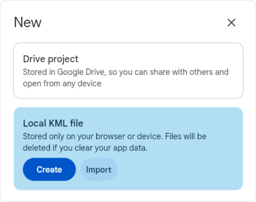
- Click the New project button.

- Click Local KML file and then click Import.

- Select the KML or KMZ file from your device and click Open.
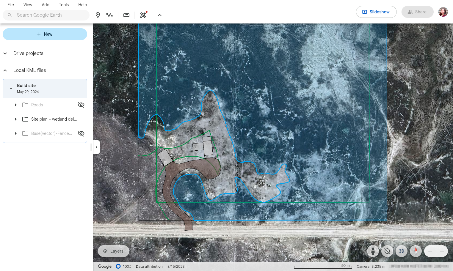
Your KML file will appear in your Projects panel as shown below.

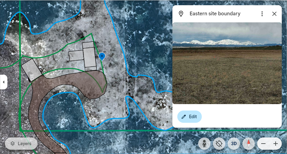
Now that you have your site plan in Google Earth you can edit the display properties, pinpoint your location on the map, and add markers with notes or images in places of interest.

To learn more about what you and your clients can do with Google Earth, check out the tutorial Create a map or story in Google Earth Web.
To learn more about creating KML or KMZ files in Surfer, check out the article Display contours from Surfer in Google Earth and note that the workflow outlined in this article can be applied to multiple map types.


