Don’t Roll the Dice—Do the Proper Analysis: Addressing Land Subsidence Geohazards for Innovative Infrastructure Design & Construction
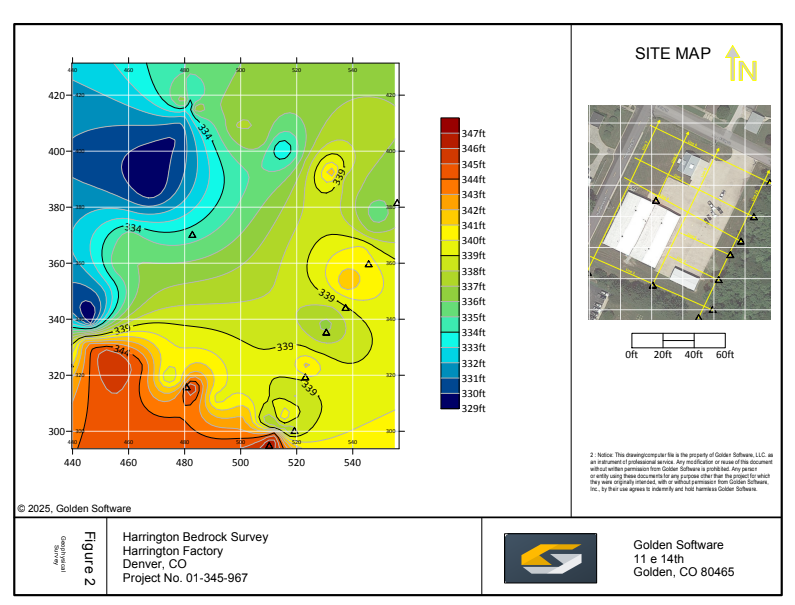
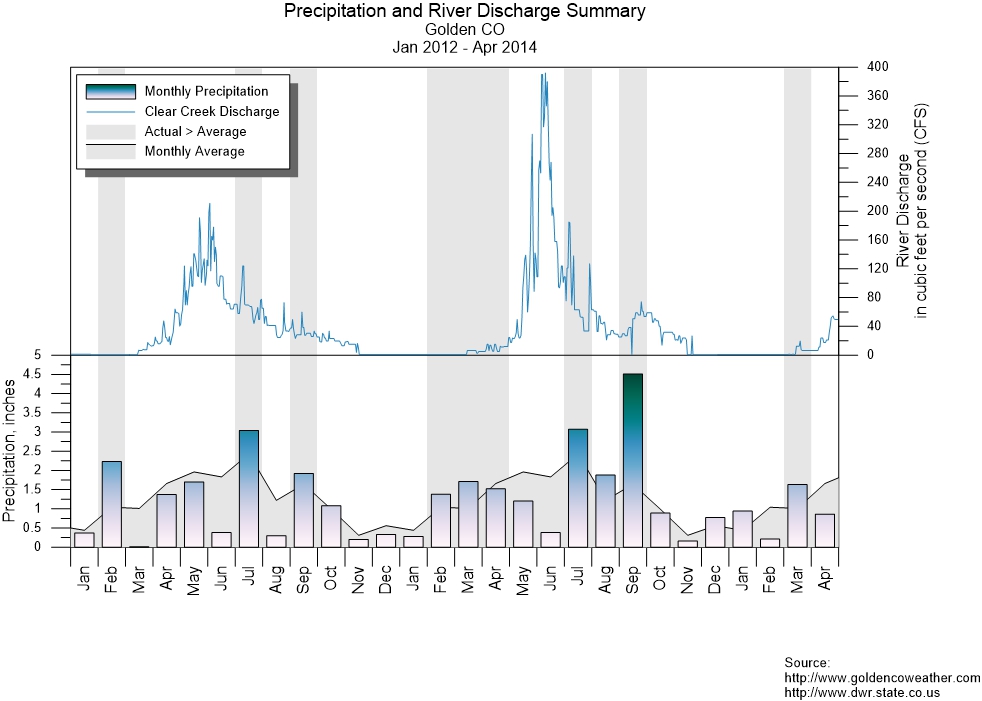
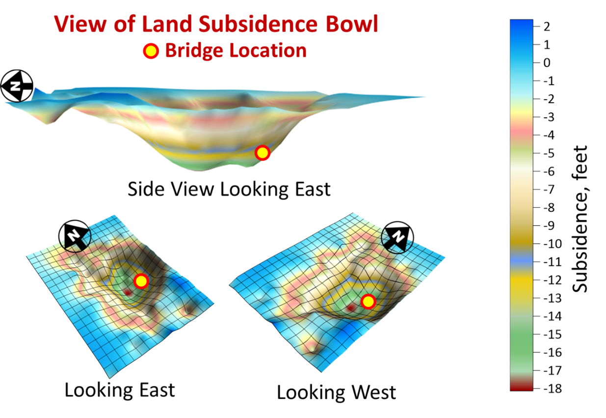
Don’t Roll the Dice—Do the Proper Analysis: Addressing Land Subsidence Geohazards for Innovative Infrastructure Design & Construction If you're designing and constructing infrastructure in certain areas of the U.S., there's one big risk you can't afford to ignore: land subsidence. In various parts of the [...]