How to Break Down Communication Silos on Geoscience Teams
Geoscience projects are built on collaboration, but even the most capable teams can struggle with communication silos. Information can easily become fragmented with datasets and project files stored in separate folders, passed along in isolated conversations, or embedded in software files you can’t quickly access.
No one is intentionally withholding information. It’s simply hard to find—and if you want to overcome that obstacle, there’s one solution that can help: break down communication silos.
What Are Communication Silos?
Before exploring tips and tricks for removing communication silos, let’s first define the problem more clearly.
Communication silos form when information stays trapped within certain teams, workflows, or systems instead of moving openly across a project. As a result, teams may unknowingly work from the following:
- Different datasets
- Different assumptions
- Different project expectations
- Different versions of a project file
What’s important to keep in mind is that communication silos are rarely intentional. More often, they develop gradually as projects become more complex, teams become more specialized, and information spreads across multiple tools, files, and conversations.
But while communication silos are rarely intentional, the challenges they present are still significant. Even small disconnects can create larger problems downstream. When critical information doesn’t move efficiently between teams, collaboration slows, context gets lost, and project decisions become harder to align.
Strategies for Breaking Down Communication Silos
The good news is that communication silos are not permanent problems. You can reduce them significantly without overhauling how your organization operates overnight. Often, the biggest improvements come from small but consistent changes that make information easier to share, access, and understand across a project’s lifecycle.
Here are practical strategies you can use to break down communication silos, creating a more connected, informed, and transparent project environment for your geoscience team.
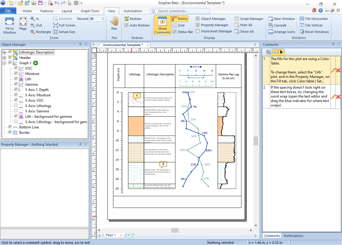
1. Use in-product comments to preserve context
One of the biggest reasons information gets lost is that important decisions and notes are never documented where the actual work happens.
Project knowledge often disappears when:
- Decisions are shared only in verbal conversations
- Workflow changes are never documented
- Customizations exist without explanation
- Assumptions are understood by one person but never communicated to others
To preserve critical project information, a great solution is to leave comments directly on a project file so team members don’t have to hunt for context. Examples of helpful comments include:
- Workflow decisions
- Customizations
- Important findings or insights
- Why decisions were made
- What assumptions were used
- How conclusions were reached
In Surfer and Grapher, for example, you can add comments directly within project files to explain analysis methods, formatting decisions, customizations, visualization choices, and any other important findings team members should know as they collaborate with you.
This level of transparency helps others quickly understand how and why work was completed. It also reduces confusion when projects are revisited months later or handed off between departments.
2. Standardize workflows across teams
Communication becomes much easier when teams have similar processes for organizing and collaborating. To experience this in your work environment, standardize processes in the following areas:
- Data organization
- Naming conventions
- Deliverable creation
- Version control practices
With this consistency, you and team members will spend less time searching for files, asking for clarity, and working on the wrong things. To put this into perspective, here’s an example: perhaps you’re collaborating with a GIS specialist and hydrogeologist on groundwater monitoring projects, and you’re all using the same file structure and naming conventions. That standardization makes updated datasets easier to locate and reduces the likelihood of duplicate work or outdated files being used downstream.
3. Centralize documentation and project information
Information scattered across emails, personal desktops, and isolated folders is difficult to maintain and even harder to trust. In geoscience, this can lead to a versioning nightmare, where multiple team members are inadvertently working from different iterations of the same visual.
To ensure project integrity, centralize these resources in a shared, accessible location:
- The “master” dataset: Ensure everyone is pulling from the same primary data source.
- Workflow documentation: Record the specific interpolation methods (like Kriging or Triangulation with Linear Interpolation) used for a project.
- Version history: Use clear naming conventions—such as SiteName_Date_v01—to avoid the confusion of files labeled Final_v2_USE_THIS.
By storing these materials in a single, accessible place, you reduce information loss and ensure that every team member is operating from the most current and verified information.
4. Align on objectives and stakeholder questions early
If teams are unclear about project goals, expectations, reporting requirements, and other strategic details, they may head in different directions without realizing it. By the time inconsistencies are discovered, significant rework may already be required.
To prevent this from happening, clarify these strategic guardrails before a project starts:
- The key stakeholder question: What’s the primary problem you’re solving? Whether it’s assessing if a plume is migrating off-site or calculating the total volume of contaminated soil, communicate the main goal to team members.
- Budget and resource constraints: Define the financial limits so teams don’t design a high-cost, extensive data collection method that exceeds the project’s actual budget.
- Regulatory requirements: Clarify if there are specific data density or reporting standards required by law that will dictate your field methods.
- Level of uncertainty: Discuss how much uncertainty stakeholders are willing to accept, which will help determine the required sampling effort.
Aligning on these key elements before data collection begins ensures the foundation for your project is fundamentally robust. When all team members are unified around the core points, you’ll protect your workflow from costly course corrections and empower everyone to move forward with confidence.
5. Improve communication between field and office teams
Field teams often observe critical details that never fully appear in raw datasets.
Unexpected soil conditions, access limitations, weather impacts, and unusual site observations can all influence interpretation later in the workflow. If that context is not communicated clearly and quickly, office teams may make decisions using incomplete information.
To improve alignment, field observations and decisions should be:
- Documented clearly
- Shared promptly with office teams
- Updated regularly throughout the project
For example, a field technician encountering unforeseen lithological changes during drilling should share notes and observations with the office modeling team before gridding or visualizing begins. That additional context can significantly improve interpretation accuracy and reduce avoidable revisions later.
6. Encourage cross-disciplinary collaboration
Breaking down communication silos requires creating opportunities for collaborative discussion. This helps teams better understand dependencies, challenges, and downstream impacts across the project lifecycle.
You can foster better communication by trying the following:
- Joint project reviews
- Problem-solving sessions
- Open discussions across disciplines
A clear example of this is when geoscientists and engineers meet during project reviews to discuss how field collection methods influence accuracy and final visual outputs. These conversations help teams move from isolated execution to shared problem-solving.
7. Create a culture where questions are encouraged
Team members may worry about slowing others down, appearing inexperienced, or interrupting workflows. As a result, assumptions can go unchallenged until they eventually become larger project problems.
Strong teams create environments where clarification and discussion are encouraged early and often. This includes promoting the following:
- Open clarification
- Feedback loops
- Collaborative discussion
- Early identification of concerns
You can promote these elements during weekly check-ins, where you encourage team members to raise questions or flag uncertainties before deliverables are nearly complete. When teams feel comfortable doing this, issues are identified earlier, assumptions decrease, and collaboration becomes more natural across disciplines.
Stronger Communication Creates Stronger Projects
Communication silos develop when information becomes disconnected across workflows, departments, and project phases. But in geoscience, disconnected information creates problems.
A missed field observation, an outdated dataset, or an undocumented assumption can ripple through interpretations, deliverables, and decisions. That’s why breaking down communication silos is so critical. It improves project quality, efficiency, and confidence.
More importantly, in a regulated industry, your communication trail is part of your project’s defensibility. When silos are gone, the ‘why’ behind a specific interpolation or site assessment is preserved for audits and peer reviews.
Now we’d love to hear from you: what’s the biggest communication challenge your team has faced during a geoscience project—and what helped solve it? Leave a comment and share your experience.
Recent Articles
- Jul 1, 2026|Gabbie Rhodes|7 min
Geoscience projects are built on collaboration, but even the strongest teams can struggle with communication silos. Learn how to overcome them.
- Jul 1, 2026|Gabbie Rhodes|7 min
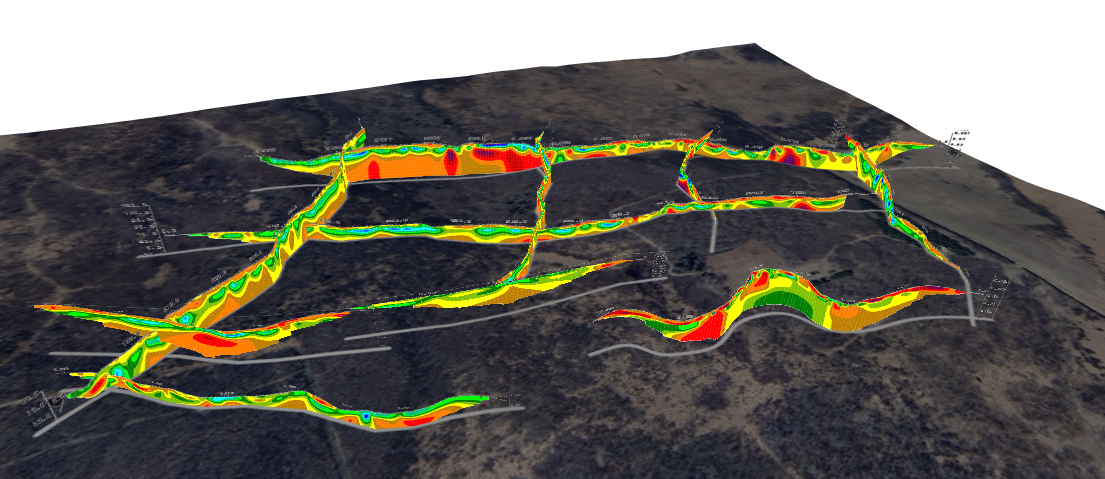
See how 3D visualization transforms geophysical data by connecting profiles with terrain, boreholes, and other datasets for better interpretation.
- Jun 23, 2026|Gabbie Rhodes|10 min
Ever stop and wonder: does AI make mistakes? Before you start using AI tools to create your maps, discover the answer to this key question.
- Jun 23, 2026|Gabbie Rhodes|7 min
What contributions are women making in STEM? Discover eight examples of women in STEM fields and the meaningful impact they’re making.