- Jun 17, 2026|Gabbie Rhodes|11 min read
Senior Technical Sales Specialist Drew Dudley hosted a webinar to provide tips for ensuring coordinate systems display accurately and consistently.
About Golden Software
Since 1983, Golden Software has been at the forefront of scientific data visualization.
Today, we empower professionals to solve real-world problems by transforming complex data into clear, impactful visual stories through our industry-leading software and legendary customer support.
Surfer – Create an Immersive 2D/3D Model in Under 2 Minutes!
Grapher – If You Can Imagine It, You Can Graph It!
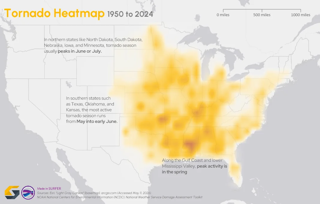
- May 20, 2026|Gabbie Rhodes|14 min
To truly answer the question, "what damage can a tornado cause," the first step is analyzing broader patterns across communities and landscapes.
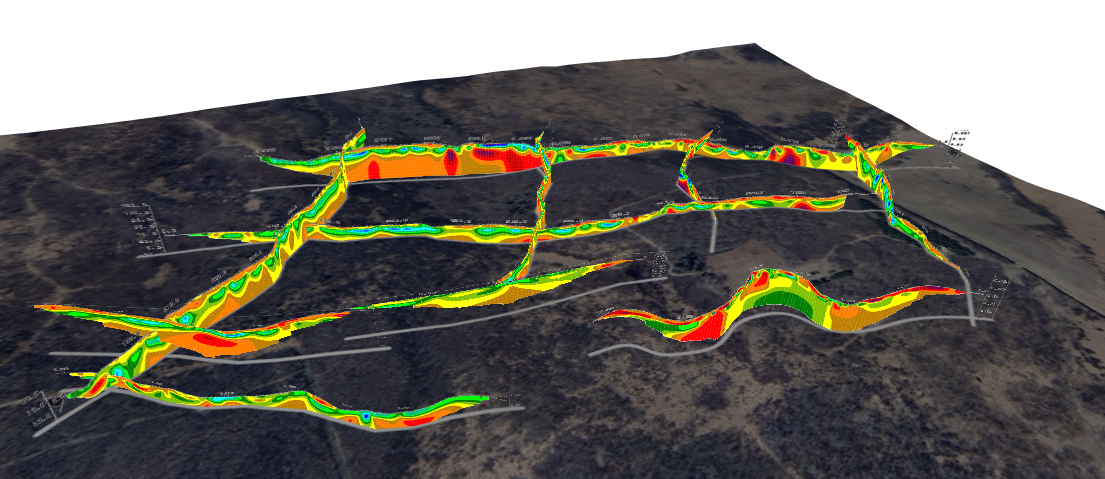
- May 20, 2026|Gabbie Rhodes|7 min
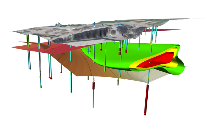
The gap between analysis and true spatial understanding has real consequences in subsurface mapping. 3D modeling closes that gap.
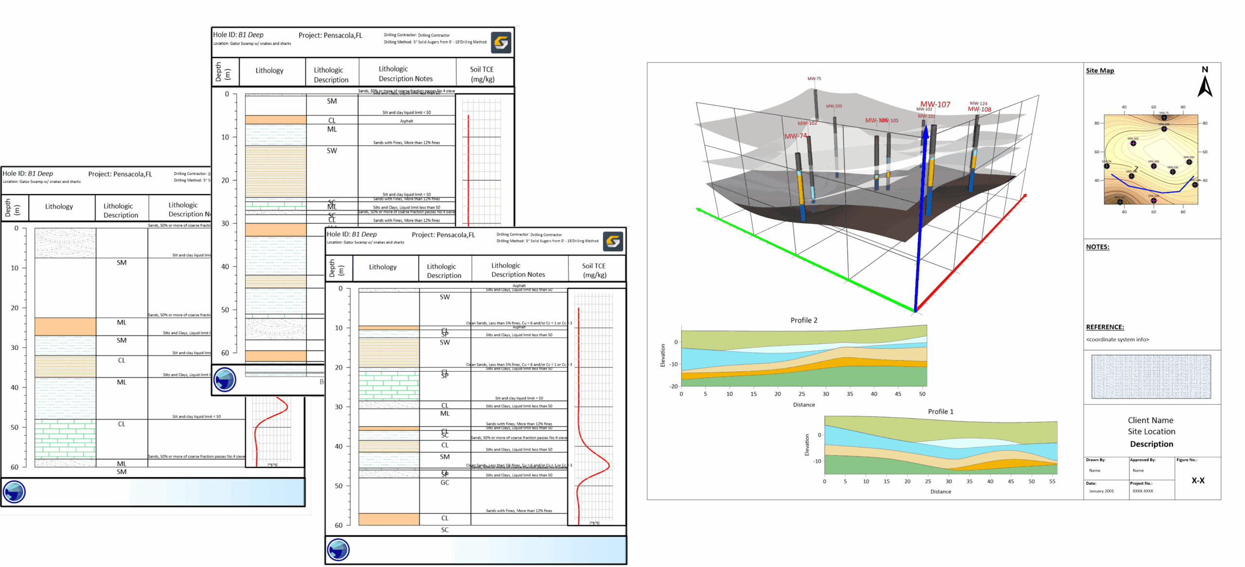
- Mar 20, 2026|Gabbie Rhodes|6 min
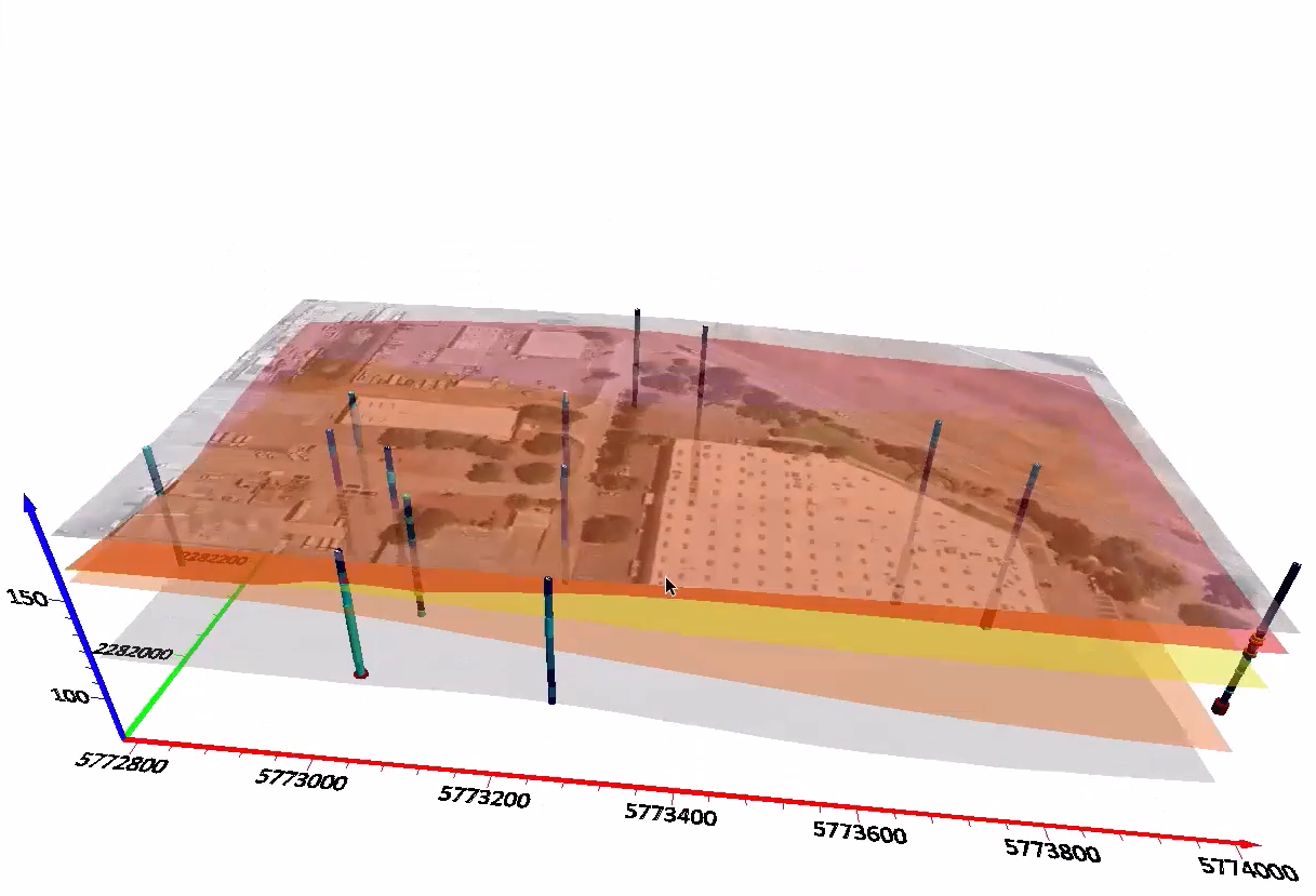
In a recent webinar, Drew Dudley showed how to transform raw borehole data into polished 2D borehole logs and 3D models.
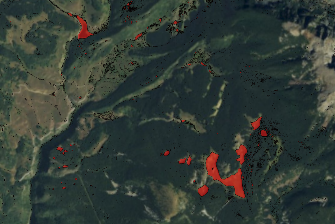
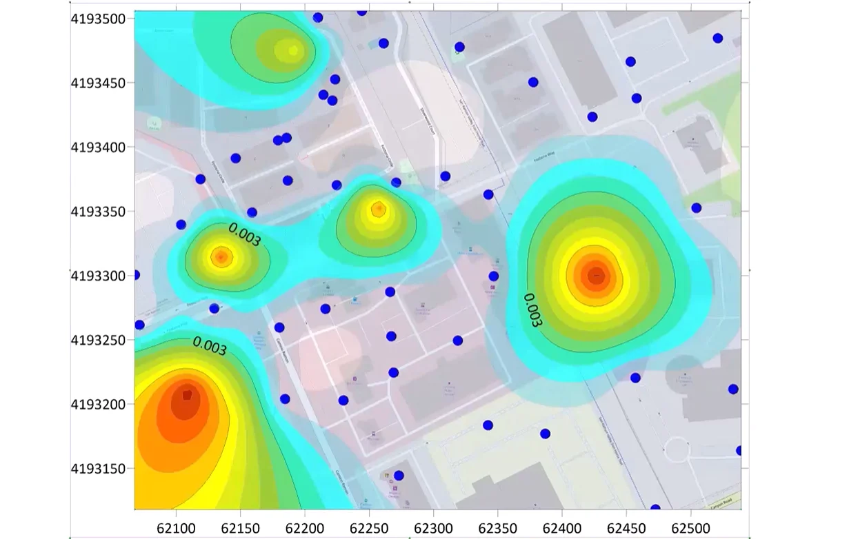
- Jan 20, 2026|Gabbie Rhodes|5 min
A regional hydrologist does rapid assessments of sinkholes, leveraging a peaks and depressions map. Learn why the map is so powerful.
- Jan 20, 2026|Gabbie Rhodes|3 min
As an environmental consultant, you can use 3D to enhance your data communication skills so stakeholders better understand your findings.
- Nov 26, 2025|Gabbie Rhodes|4 min
Want to easily create 3D contact picks and surfaces from your drillhole data? Surfer now equips you to do that very thing. Learn more.
- Sep 24, 2025|Gabbie Rhodes|5 min
Do you want to showcase underground feature with clarity and precision? Create contact drillhole contacts and surfaces show lithologies & more.
- Jul 16, 2025|Gabbie Rhodes|6 min
To complete a project successfully, sometimes you need to convince your decision-makers to spend more money on analysis. Learn how.
- Jun 25, 2025|Gabbie Rhodes|9 min
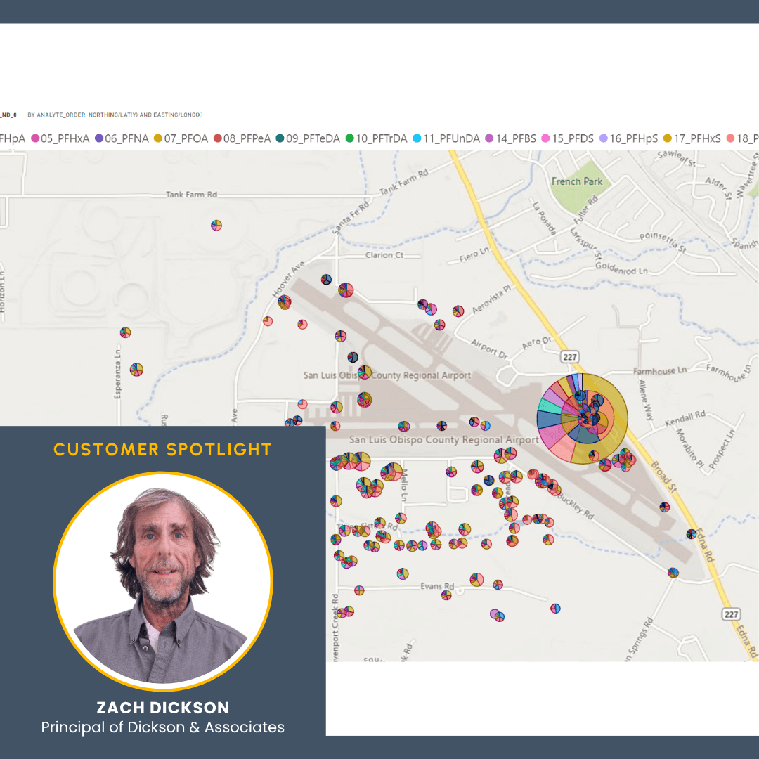
PFAS at California airports are an issue. But how can researchers and the public truly understand the problem? A PFAS model can help.
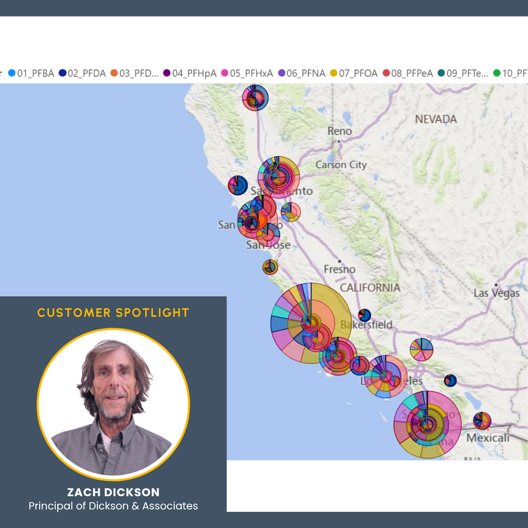
- Jun 17, 2025|Gabbie Rhodes|8 min
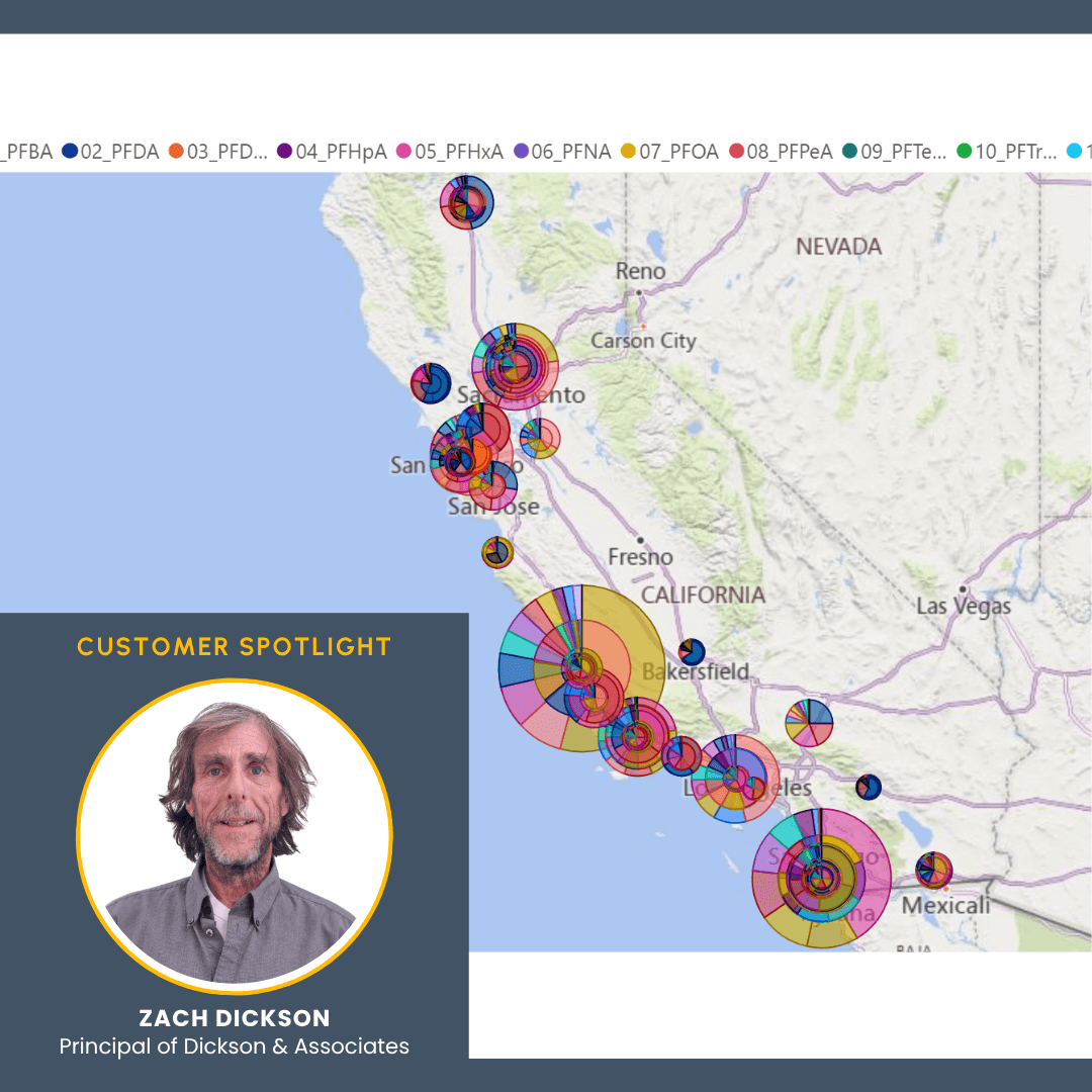
PFAS is a growing concern in California. However, to better understand the situation, Zach Dickson created a model showing PFAS in California.
- Jun 10, 2025|Gabbie Rhodes|6 min
PFAS is a growing concern in Colorado. However, to better understand the situation, an model was created to visualize PFAS in Colorado.
- Jun 3, 2025|Gabbie Rhodes|8 min
PFAS is an increasingly urgent problem in the U.S., but sometimes, it's hard to understand its impact. Fortunately, new interactive models can help.