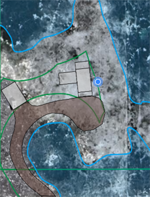
- May 30, 2024|Katie Yoder|3 min read
Use Google Earth and a KML version of your site map to see exactly where you are on the site, add points of interest, take photos, and add notes.
About Golden Software
40 years ago, Golden Software began as a small company that develops, sells, and supports scientific visualization software.
Today, we still develop, sell, and support scientific visualization software, and more.
Surfer – Create an Immersive 2D/3D Model in Under 2 Minutes!
Grapher – If You Can Imagine It, You Can Graph It!
- May 23, 2024|Katie Yoder|2 min
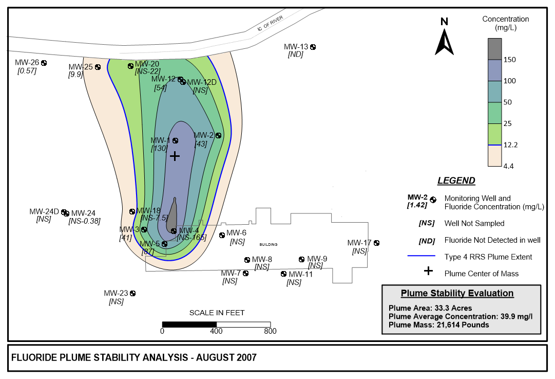
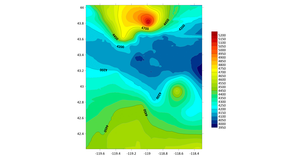
The Ricker Method for plume stability analysis helps engineers communicate meaningful patterns in environmental data
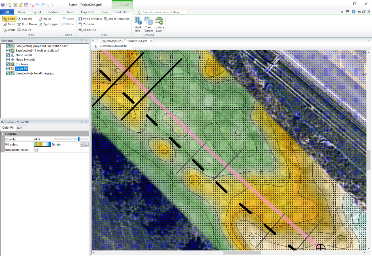
- Feb 27, 2024|Katie Yoder|3 min
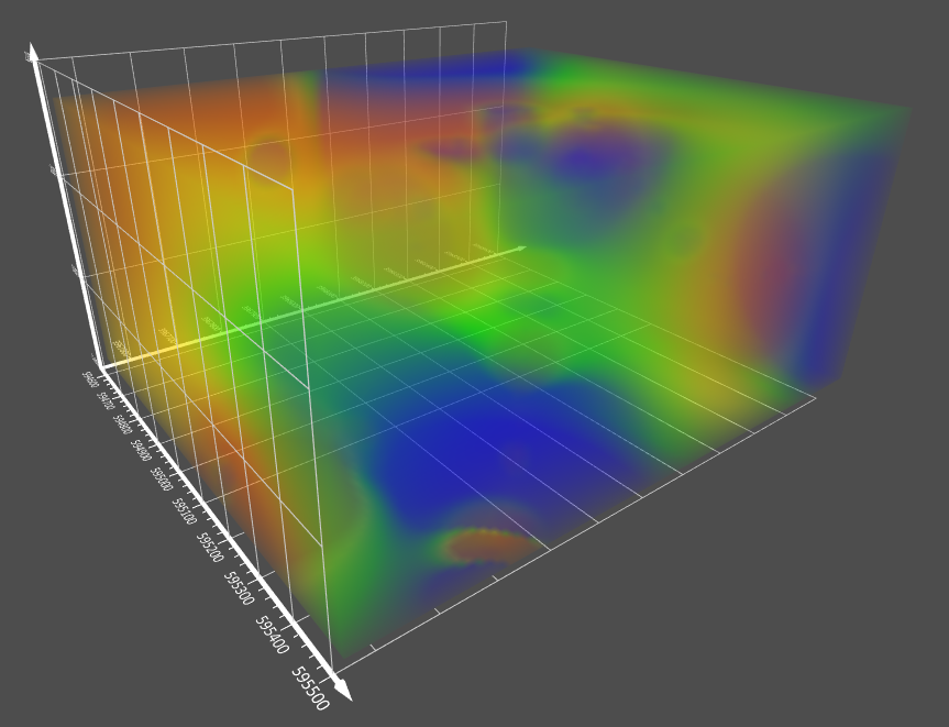
The latest version of Surfer adds 3D modeling functionality that include dynamic visualization tools and improved export and collaboration options.
- Feb 9, 2024|Katie Yoder|3 min
Zach Dickson, principal hydrogeologist, recently shared how he uses Surfer to model his site characterization and forensic analysis data.
- Sep 14, 2023|Jake Stachewicz|3 min
The latest version of Surfer adds 3D modeling functionality that include dynamic visualization tools and improved export and collaboration options.
- Mar 29, 2023|Jake Stachewicz|3 min
With Surfer any scientist or engineer can utilize powerful 3D modeling functionality to create the site models they need. Ultimately helping you reduce you software toolkit and create 3D models that leave a lasting impression on clients.
- Feb 14, 2023|Jake Stachewicz|6 min
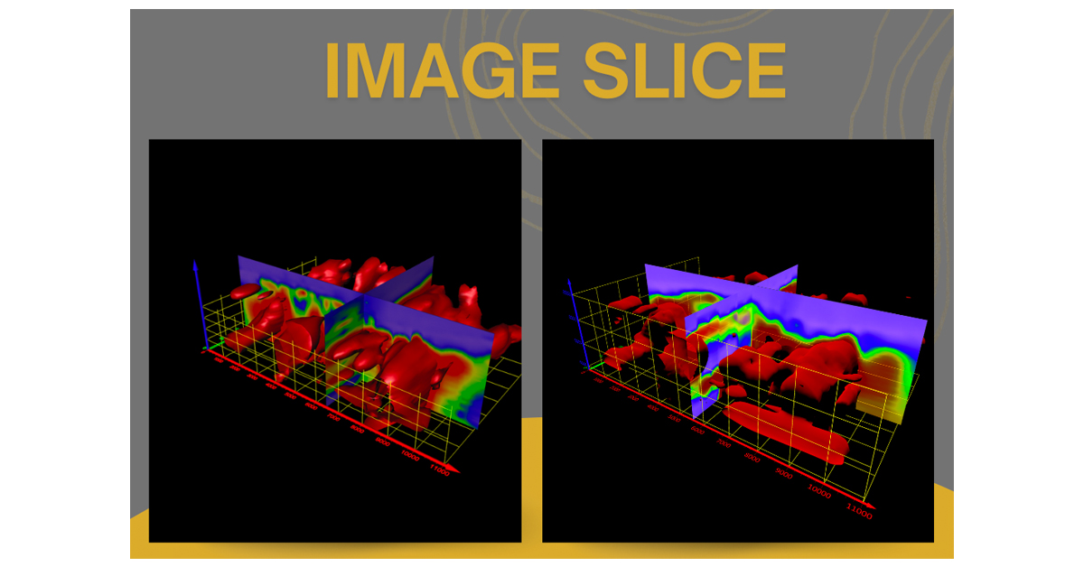
A new version of Surfer is here with highly anticipated 3D gridding features. With 3D gridding you can interpolate and map XYZC data.
- Jan 3, 2023|Jake Stachewicz|4 min
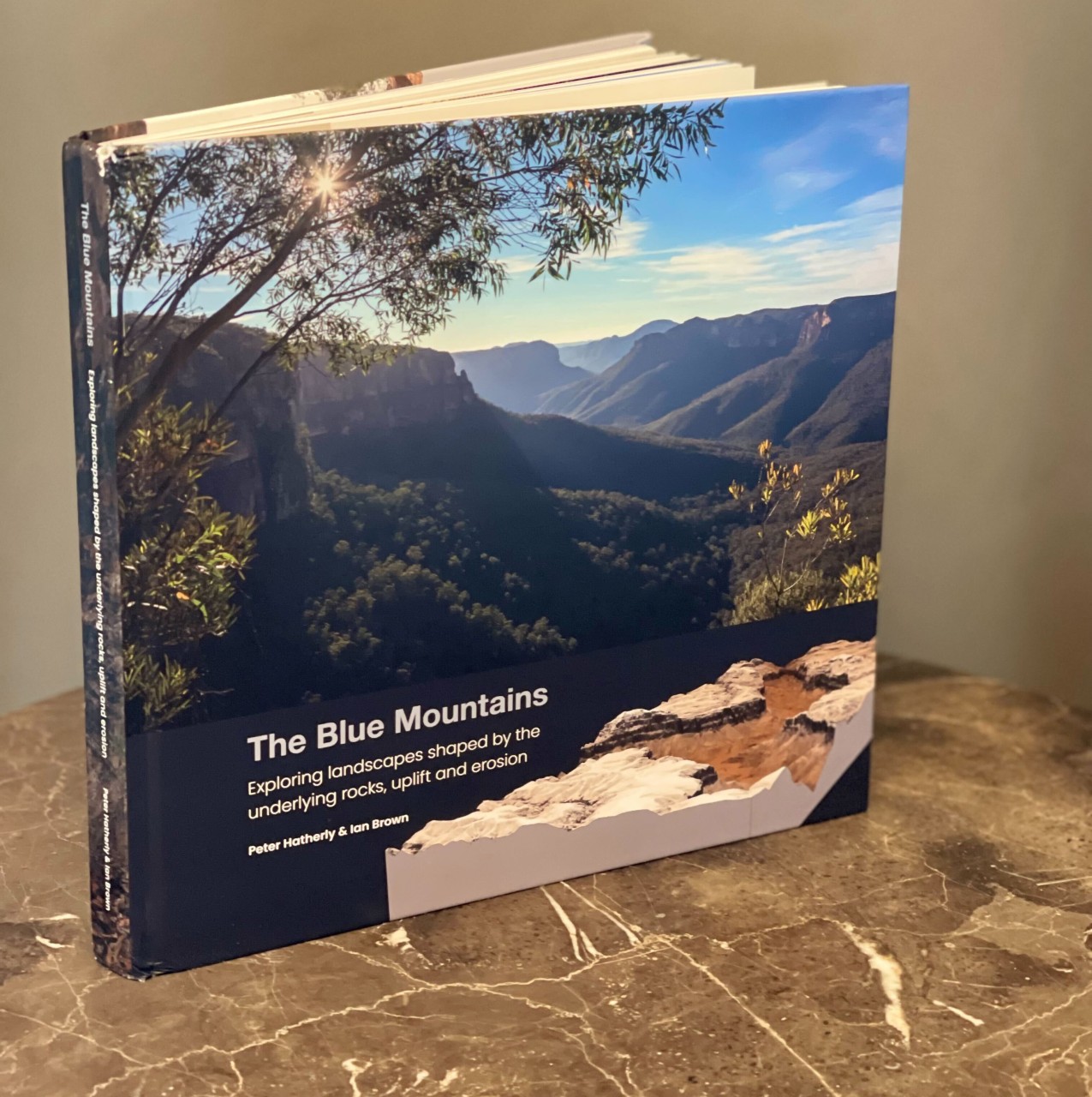
A geophysicist used Surfer to create multiple visualizations for his guidebook on the geology and history of the Blue Mountains in Australia.
- Sep 19, 2022|Jake Stachewicz|2 min
With the latest Surfer release there are exciting new display options to help you better tell the story of your data.
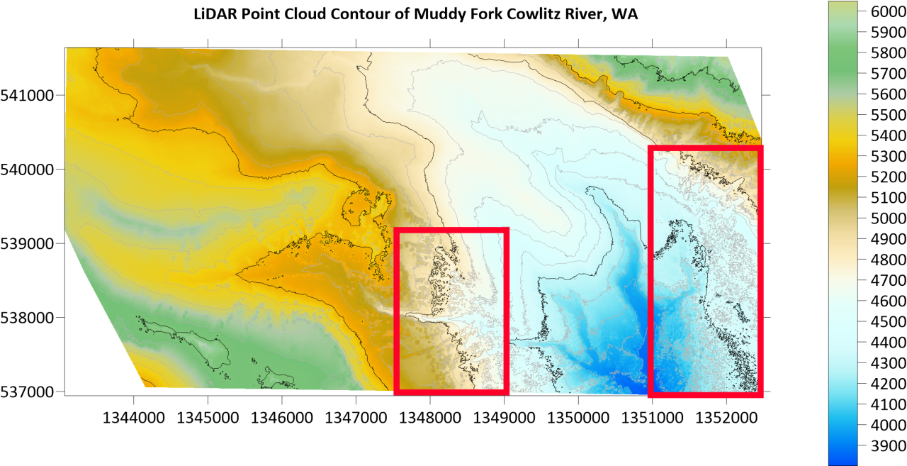
- Feb 22, 2022|Jake Stachewicz|7 min
As LiDAR data continues to become more prevalent you need to know the methods to reduce a common headache, LiDAR noise.
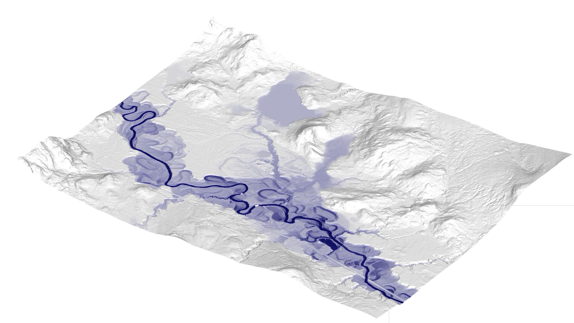
- Aug 9, 2021|Jake Stachewicz|3 min
The rivers of New England are prone to eroding into Oxbow lakes. This blog describes the depositional process and how it can be mapped in Surfer.